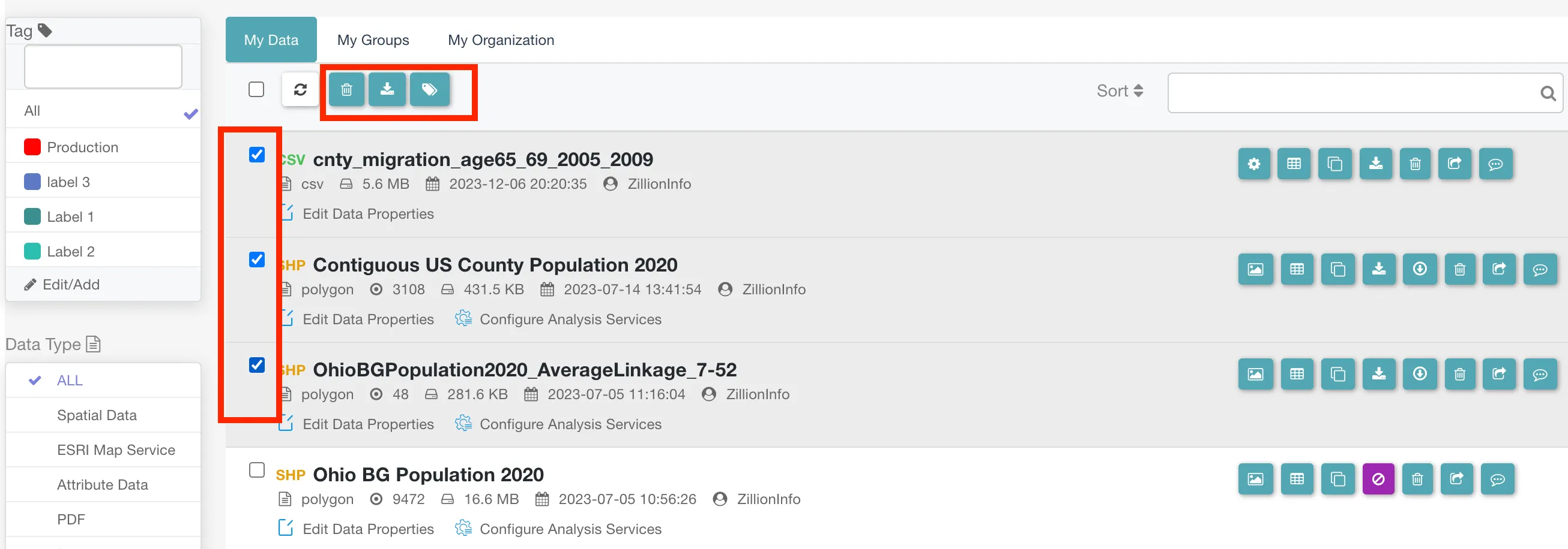
Other Features
Delete, download or tag multiple files.
Create a shapefile from a CSV file containing latitude and longitude fields.

Show data in the table.

Duplicate, download and delete the data.
.Bnyz2RnD_ZQ7LtK.webp)
Share data to the group or the organization.

Add comments to the data.

The SHP data includes additional features for map visualization and allows downloading in GeoJSON format.